Home
Evening Walks
Day Walks
Wednesday 14 November 2007
A Circuit from Eccles Metro Station, featuring Worsley Woods and the Bridgewater Canal
Started outside Eccles Metro Station at 1.30pm for this 12 km stroll.
See Blog for a brief report, plus comments in the text below.
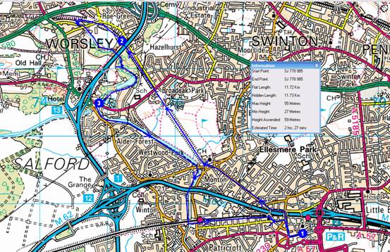
Route Summary
1->2->3->1
Instructions
NB The distance is the flat length to the
next Waypoint. Timing is based on Naismith's calculation of 5.00 Km/hour
and 600 Metres ascent adds an hour.
Overview
1->2->3->1
1 SJ 778 985 Eccles Metro Station
1->2 4.21 km 37 metres ascent 54 mins
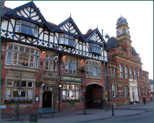
From the Metro station continue in the same direction down Regent Street. Turn right opposite the Duke of York, signed 'Eccles Market'.
Continue, with Eccles Shopping Centre and Orbit House on your right before crossing a bridge over the railway and the M602 motorway. Turn 1st left down Wellington Road as far as a roundabout where you bear left onto Monton Road. Follow this until the roundabout at Monton Green, before which the spire of Monton Church comes into view. At the roundabout urn left and cross over. Go past the church and past Stableford Ave then go 1st right up a narrow tarmac path where a sign introduces 'Monton Green' (Note 1) . This is the boring bit done.
Go to the top of the old railway embankment.
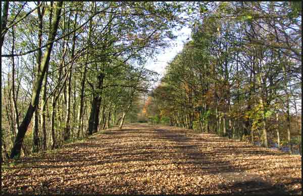
The footpath heads NW through Broadoak Park, also 'Cycle Route 55'. It is all that remains of the Tyldesley Loop, a railway line that was axed by Beeching in 1965.
Continue under Worsley Road by way of a tunnel past the site of the old Worsley Station, and on to go under the M62, reaching a little nature pond on the far side on the left.
2 SD 752 014 By M62 motorway
2->3 2.80 km 9 metres ascent 35 mins
Continue and after 5 minutes, at Roe Green junction (Note 2) , take the left fork towards Wigan, under the left of twin bridges carrying Green Leach Lane over the railway. About 100 metres beyond this bridge, just past a footbridge over a stream, take the path which slopes up the embankment to the left which meets a crossing path at a stile.
Turn left through a metal gap into a narrow alleyway between a garden hedge and a wall, leading into Lumber Lane, the edge of Roe Green with scattered victorian cottages and new luxury houses.
Turn left to the end of the lane to its junction with Green Leach Lane. Cross over, and almost immediately to the right, three concrete finger posts lead into a track by woods. After about 50 metres turn left through a gap into the woods, along a leafy path that descends to stepping stones over Kempnough Brook. Go left to turn right down a broader track signed to Woodlands.
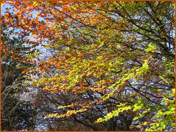
Keep on this path for about 1 km, keeping to the left of the brook, deep in the mature woodland of Worsley Woods. Oak, beech, chestnuts and rhododendron abound.
The path returns to the motorway embankment, and follows a concrete canyon under the noisy road.
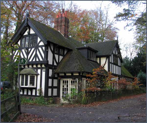
At the gate by the black and white lodge shown above, take the right hand, narrower track which leads past willows and wetland before going past a dam and past iron railings to join Mill Brow by attractive white painted cottages, to emerge at Worsley Delph, an ancient flooded sandstone quarry where tunnels led into 52 miles of underground channels serving the Duke of Bridgewater's coal mines.
Emerge onto Worsley Road.
3 SD 748 004 Worsley Road
3->1 4.72 km 14 metres ascent 58 mins
Cross Worsley Road to where, beside a telephone kiosk, steps lead down to a walkway which crosses the canal at a footbridge, past the half-timbered Packet House (Note 3) to emerge onto Barton Road.
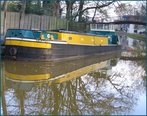
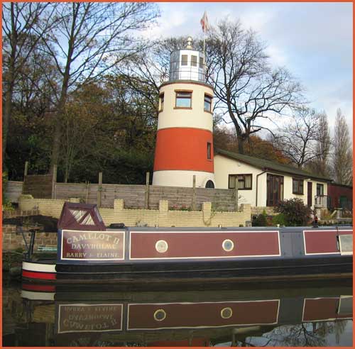
Cross the road and turn left over the canal bridge, at the far side of which concealed steps lead down to the canal tow path. Turn right, back under the bridge, following the tow path past the pretty canal basin with its barges and houseboats, past lawns and grassy verges before proceeding down a long easy stretch of canal, with Monton Church a landmark ahead.
Follow the canal tow path and go under Parrin Lane, the first road you reach. [Note that in November 2007 the canal path was closed shortly beyond head, so at this point you could leave the canal, go to Monton Church, and return by the outward route.]
Regaining the urbanity of Monton, go past the enticing smells from the Waterside Restaurant, continuing under the M602 and under the railway, after which go immediately right and double back over the canal to follow a walled path by the railway. Emerge to cross a busy road and follow a path signed to the Town Centre. This passes between the railway and back gardens to emerge at a road. Pass the headquarters of Air Training Corps No 292 (Eccles) Sqn. Continue ahead through a ginnel at the end of the road, past a footbridge over the railway and on along the increasingly overgrown path between railway and houses.
Eventually emerge at a bridge by a church. Turn right then left at Chadwick Road, crossing onto Lower Monton Road and heading towards an Aldi sign. Continue straight on, heading for the clock tower of the Town Hall, from where the Metro Station draws back into sight.
1 SJ 778 985 Eccles Metro Station
Total trip 11.73km 60 metres ascent 2 hrs, 27 mins
Note 1 The former London and North West Railway Company Ltd was officially opened on 1 September 1864, and helped to provide a link between Eccles Junction on the Manchester/Liverpool line and Tyldesley Junction on the main west coast line. The former Monton Green station was opened in 1887 to cater for commuters to Manchester and Liverpool. Traffic included everything from coal, to David Brown tractors from their Leigh factory, to holiday specials to Blackpool.
The line was finally close to all traffic on 5 May 1967 by British Rail.
Since the 1980s the line has been progressively reclaimed and now forms an integral part of the Salford Loopline network of ‘Strategic Recreation Routes’
Wildlife abounds on the loopline, where the steep sides of the embankment were originally planted with sycamore and beech, since when oak, ash rowan and birch have joined the party. Dog Rose, Blackthorn, and the Common Blue Butterfly are common here. Keep your eyes open for kestrels, woodpeckers, yellowhammers and foxes, as well.
Note 2 Roe Green junction is where the Eccles to Wigan (1864) line met the Worsley to Bolton (1870) line. On 28 March 1874 the local paper reported gleefully that…”the long looked for new line between Bolton and Manchester on the London and North Western system will be opened for traffic and will meet a great public requirement by the supply of additional means of railway with the busy cottonopolis.”
Note 3 The Packet House was built in the late 18th century as separate dwellings, the mock Tudor frontage being added later. From the stone steps in front of the Packet House travellers were collected by the Duke of Bridgewater’s packet boats for journeys to Manchester, Warrington and Runcorn. The golden age of the canal ended with the railways on the disused lines of which this walk starts. So whilst the canal would have been a hive of activity 200 years ago, whilst today it is more of a recreational zone, it still works and is full of water, whereas the railway lines are long gone…