Dolomites Trip - 19 to 27 July
2003
Note - if you want to print this page you may need to change
left and right hand margins to 0.05cm ('page set up') to avoid losing the edges.
The page has been retained in part following the trip in order to provide useful
information and links for others wishing to plan a similar trip.
Click here to go back to the main site. And here for a report on this trip.
Contents
Venue
Team news
Maps and guide books
Kit list
Insurance
Route ideas
Useful links
Diary entries
'Camping Dolomiti' camp site, about 2 miles
south of Cortina. Tel 0436 5063.
See local map below. If travelling by public
transport, I understand a train goes from Venice to Calalzo (Calzano), where
you pick up a bus. Total travel time is said to be four hours. I am told buses
wait outside the station at Calzano, and the ticket office is in the station
foyer, so get off the train quickly and you wont need to queue for too long.
A full timetable is available at the Italian
Railways web site. Train tickets must be bought before boarding the train
and must be stamped with special machines located on each platform.
Those of us travelling from Munich usually seem to encounter a tropical storm before passing Innsbruch and stopping at the Vipiteno service area just across the Italian border. We then go via Dobbiaco to reach Cortina hopefully by 6pm (6 hour journey).
The team who went are now shown on the Dolomites stories page
Via Ferrata Scrambles in the Dolomites
- translated by Cecil Davies (Cicerone) -"the old guide"
Via Ferratas of the Italian Dolomites: Vol 1 - John Smith and Graham Fletcher
(Cicerone) - "the new guide"
Walking in the Dolomites - Gillian Price (Cicerone)
Shorter Walks in the Dolomites - Gillian Price (Cicerone)
Cicerone guides are available by mail order from Cicerone
Adventure Travel magazine had a 48 page guide to Via Ferrata in issue 37 (Jan/Feb 2002) and has been harping on about them ever since. Back issues can be obtained by calling 01789 450000 (£5 each, min order £10, so why not go the whole hog and get issue 43 as well, with its 24 page Austrian Klettersteig [aka Via Ferrata] Special).
There are many different maps to choose
from. The main publishers are Tabacco and Kompass. I like the Kompass 1:25000
Cortina d'Ampezzo - map number 617.
Gillian Price prefers the Tabacco maps - number 1 in the 1:50000 series covers
Cortina, Gillian's book indicates that numbers n.03, n.07 and n.010 may be needed
for the walks in her book in the Cortina area.
Maps are readily available in Cortina and also from Stanfords (020 7240 3611
or sales@stanfords.co.uk) or The Map Shop
There is lots more information available on Cortina's
web site
This list may include items not everyone will need - it's intended as a checklist and whilst not exhaustive does cover both essentials and luxuries!
Gloves - for via ferrata - the steel ropes
can abrasive. Specially designed gloves can be bought in Cortina, resembling
cycling gloves (padded palms and cut off fingers). Some people use ordinary
gloves (needed anyway in case it gets cold), others use cheap gardening gloves,
others don't use them at all.
Climbing gear (if going on via Ferrata) - Zyper / 3 Screwgate carabiners / harness
/ helmet. 'Via ferrata kits' used to be unknown to most UK outdoor shop salespersons,
but now any reputable shop should stock them. On the easy routes that most of
us enjoy, I have not yet encountered rockfall. But the use of a cycle helmet
is apparently risky - a proper climbing helmet is therefore advised - it's up
to you...
Torch for tunnels (keep in day sac) / spare batteries / candle if desired
Rucksack or large bag
Tent or arrangement to use one
SleepingBag / Liner / Karrimat or Thermarest
Cagoule / Overtrousers / Fibrepile / SunHat
Walking-poles (optional)
Walking Socks / Underwear / Shirts / Swimming trunks
Stove or access to one (don't bring gaz by air) / Pan / Mug / Plate / Bowl /
JCloth / Scourer / Knife / Fork / Spoon / Lunchbox /butty bags
Water Bottle(s)
Food for journey / special teas / other special requirements / there are restaurants
+ supermarket in Cortina (the Coop is like a department store and supplies everything
- staying open until around 7pm)
Trainers or sandals / Boots or all terrain shoes
Day sac plus liner
Camera / Binoculars / Film / spare batteries for torch and camera / Tripod
Map (Kompass 617-available in Cortina )/ Guide Book / Pen / Paper / PhraseBook
/ Book to read / Bogroll
Clock / watch
Glasses / contact lenses (for the poor sighted )/ Glassescase / Cloth Cleaner
/ Sunglasses
Compass / Whistle / First aid kit
Can Opener / penknife
Suntan cream / lipsalve
BootWax
ToothBrush / ToothPaste / Dental floss / Shampoo / Razor (if prone to hairiness)
/ Comb / Towel
Elastoplast/ Aspirin / Diocalm / Savlon / Wipes
LuxFlakes or similar to dunk sweaty underwear
Matches / needle / thread / tape
Passport / driving licence / currency (suggest around €300 plus credit
card - there is a cash machine in Cortina) / English Money / Tickets / Insurance
papers (if doing via ferrata, check you are covered, also bring details of household
policies) [If you need cover try Snowcard]
Timetables / other papers / Addresses for postcards / This List / Keys
Favourite tapes / CDs (for journey or personal stereo)
Don't leave home without it!
Try the British Mountaineering Council (BMC)
or Snowcard (01327 262805).
Take a copy of your household insurance details if you are relying on that for
possessions etc.
The old guide that has accompanied me on previous trips has now been superseded by the new guide. This new guide has grades for technical difficulty (1 - 5) and 'seriousness' (A - C), whereas the old guide just gives an a - g grading.
Any fit walker with a head for heights
should be able to cover the routes graded up to 1B. Scramblers should be alright
up to 2B. Those happy with a longer day out should be good for 2C, and those
confident with their via ferrata skills may be able to go up to 3C without complaining.
That's for all who don't climb.
Anyone with climbing skills will be able to consider attempting the grade 4
and 5 routes, but they should obviously read about the routes and judge their
capabilities accordingly. Good technical climbing ability is required.
These notes are aimed at non-climbers - whilst the climbers amongst us will
no doubt enjoy them, I appreciate they are more than capable of carrying out
their own further research.
Set out below are notes on some of the routes readily accessible from Cortina.
You will find that those in the Cortina, Falzarego and Misurina areas can all
be reached within 30-45 minutes, whilst it will take a little longer to get
to the Arabba and Pedraces areas.
Please take your own counsel - we have no qualified guides (except perhaps Andy) and no one is legally responsible for anyone else!
Note that the Via Ferrata routes are basically walks with aided sections. Don’t expect to spend all day clipped to the side of a mountain!
Asterisked walks are not on the 1:25000 Kompass map no 617, but are on the Tabacco map no 1 covering the Cortina area.
# - indicates I am keen on this route being
on this year's shortlist.
References give the new guide reference and grade first, with the old guide
reference and grade in italics. Walk numbers refer to those in Gillian Price's
'Shorter Walks' guide.
Cortina Area
Cort1 (1A) / 39 (c) - Barbara
- a 2-3 hour round trip with no summit. We have done this several times on wet
days. It could be combined with route 40 to make a longer day.
Walk 4 gives an excellent circuit
from Rif Ra Stua (there is apparently an 'access bus' to it) passing Fodara
Vedla, Sennes and Biella Rifugios and some scenic lakes.
Cort2 (3B) / 44 (e) - Ettore Bovero - Col Rosa 2166m – not a long day, but quite demanding (reminded me of Curved Ridge on Buachaille Etive Mor). We did this on a lovely day in 2001.
#Cort3 (3B) / 52 (d) - Michielli
Strobel - Punta Fiames 2240m - this short route has a sporting 80m section
and is exposed. ‘Sounds fun and very convenient for a short day’
is what I predicted in 1998. It certainly was fun. Perhaps it will be less slippery
or electrifying if we avoid the storm next time! Could be extended to Cort4
(2C) but that route has long unprotected sections.
Walk 5 along the old Calalzo to Dobbiaco Railway line, through woods and with
fairly frequent access to bars and bus stops, may appeal to some.
#Cort5 (2B) / 55 (d) - Marino Bianchi - Cristallo Central Summit- Cima di Mezzo 3154m - a 3 hour return trip from the top of the gondola (see Cort6), which could be followed, after a night at Rifugio Lorenzi (2932m), by either Cort6 or Cort7.
#Cort6 (2B) / 53 (c) - Monte Cristallo: Ivano Dibona High-level Path - a most excellent walk, which I have done several times. Needs a car placing at the end; starts conveniently from the top of the gondola at 2918m. Really just a good walk with occasional aids.
Cort7 (2B) / 54 (d) - Monte Cristallo: Renato Path - a slightly harder and shorter alternative to Cort6.
Cort8 (4C) / 45 (e) – Giovanni Lipella - Tofana di Rozes 3225m – quite hard, it looks as though there is also a #walker’s route to this summit. Possibly a good introduction for those with climbing skills, I think Rupert and Chris did this route in 2001.
Cort9 (1A) - Sentiero Astaldi - a geologically interesting 2 hour walk from Rif Dibona.
Cort10 (1B) - Sentiero Guiseppe Olivieri - a short route that could be included in a walk from Cortina.
#Cort12 (2B) / 47 (c) and 48 (c) - Lamon and Formenton - Tofana di Dentro 3238m - we did this excellent traverse in 1998 and really enjoyed it. Ascend by route 47 and descend by route 48, or vice versa. This is another route where a cable car takes you up to 3000m.
Falzarego Area
Falz2 (1A) / 43 (a) - Kleiner
Lagazuoi
2778m Rock Tunnel - this involves a cable car ascent to the summit and a 1.5
hour descent, mainly through a tunnel, back to the start. A very enjoyable half-day
trip.
Walk 18 covers similar ground.
Falz3 (2A) / 51 (a) - Averau
2647m and Falz4 (1A) - Nuvolao 2575m - Averau has a very short aided section
which is good practice, and spectacular views. Not a long day if you return
to Falzarego Pass, but in 2001 we continued on along the high level AV1 route
before heading back to Cortina by foot from Forcella d’Ambrizzola as darkness
fell. Walkers could get back earlier by missing out the Averau summit.
Walk 16 provides a good walk in this area, from the Falzarego road above Pocol,
to Rif Palmieri, the Forcella d’Ambrizzola and Forcella Rossa di Formin
before completing the circuit (5 hours). This route could also be done (longer)
easily in a day from the campsite.
Walk 17 describes a pleasant four hour walking route up the Nuvolao from the
Falzarego Pass.
Walk 19 - a little further west from Falzarego is the Valparola Pass, from where the 6 hour Settsass circuit starts. This looks attractive.
Misurina Area
Misur1 (1A) / 56 (d) - Monte Piano
2305m - a 4.5 hour round trip, not too hard. Could be combined with route 57
(d) - Monte Piana 2324m - short, rewarding, easily combined with route
56. (I am puzzled by the 1A grading of the new guide - I'm not sure whether
the routes are the same.) Chris and Rupert did this on a wet day in 2001.
Walk 9 goes up Monte Piana - a 5 hour trip.
Misur2 (3B) - Delle Scalette - and Misur3 (2A) / 62 (d) - Toblinger Knoten 2617m - short route from Drei Zinnen hut. We enjoyed this in 1998 apart from being hassled by Germans. Ascend by Misur2 and descend by Misur3.
#Misur4 (2B) / 60 (d) - Paternkofel 2744m De Luca - interesting route involving a rock tunnel, which could be combined with Misur5.
#Misur5 (1B) / 61 (d) - Paternkofel 2744m The Wind Gap Path - short, quite demanding, airy - possibly combine with Misur4. We must try these in 2003.
Walk 8 - Misur1 to 4 all require a start from the road head at Rif Auronzo. There are lots of good walking routes from here, including this 4-5 hour circuit, visiting Sasso di Sesto.
#Misur6 (1A) / 59 (b) - Bonacossa
Way - an easy and rewarding walk, which is always a contender for the opening
day, when those with more demanding aspirations could do Misur7, and those wanting
just to walk can do Walk 10, perhaps returning to Misurina for a stroll around
or a row on its lake, between ice creams.
Walk 10 goes to Rif Fonda Savio (an 'Apple Strudel' point) and follows the Bonacossa
route, descending before the (easy) via ferrata is reached.
Misur7 (3B) / 58 (d) - North East Cadin Spitze 2790m - 3 hour return trip from Rif Fonda Savio. It took us much longer in 1998, when we used it on our first day. Basically a long set of fireman’s ladders to a brilliant viewpoint.
Walk 11 - this is an excellent 5 hour walk from Passo Tre Croci to Rif Vandelli and back in an interesting circuit.
Pedraces Area
We have not previously explored this area to the north west of Cortina.
*Pedra3 (1B) / 37 (b) - Heiligkreuzkofel 2907m and Zehnerspitze 3026m - starts from the Pedraces chair lift. Using the lift gets you to 1829m and saves a 500m ascent. This would be a good easy walk for a short day and there is a bit of optional climbing up the Zehner for the brave, but it is 20-30 miles from Cortina.
*Pedra4 (1B) / 38 (e) - Cunturinesspitze 3064m - the guide portrays this as a tough outing, but the map indicates a much shorter possible route. It may be wise to leave any attempt to the end of the week when we know our capabilities.
#Pedra5 (2C) / 41 (d) - Southern Furcia-Rossa-Spitze 2792m - scramblers could join those walking Pedra5A as far as the Fanes Hut (3 hours), for a demanding and long day, which may also combine the Bianco summit in route 40.
Pedra5A(1C) / 40 (a) - Monte del Vallon Bianco 2687m - not really a via ferrate - just a long beautiful mountain walk. Would provide an excellent day for reluctant scramblers.
Arraba Area
We have not previously explored this area to the south west of Cortina.
*Arab3 (1A) - Sass de Rocia - a chance to visit an interesting little summit (1620m) on a 'day off' - this is an out of the way place frequented by serious climbers heading for bolted routes.
#*Arab4 (1A) - Col di Lana - traversing or summit (2452m) routes would make a good day out.
For reluctant scramblers:
There are alternatives to most of the above routes which allow good walks (or indeed climbs) to be had from the same drop off/pick up points as the Via Ferrata routes, combining some of the paths. Some of these walks are noted above, but the myriad of paths marked on map 617 leaves us spoilt for choice.
A pleasant undemanding day involves getting the cable car to Rif Faloria (2138m) and returning to the campsite by path 212. Or you can go east from Faloria to further explore this area.
Mountain bikes can be hired in Cortina - this activity is popular, but it is quite hilly!
Venice and other interesting places are accessible for a long day out for those who want a break from walking, or in the event of a wet spell.
We will keep our eyes open for the local concerts, which appear to be a summer feature of Alpine resorts.
The flora and fauna are interesting with a plethora of species to observe. Botanists may find Collins ‘Alpine Flowers of Britain and Europe’ handy.
I hope these notes are helpful - your comments on the routes taken (I'm sure we won't stay together all week) will be appreciated, so try to keep a diary that you can send to or leave with me. I'll have lots of paper!
Martin B
Cortina has an excellent web site where
you should be able to find everything you might ever want to know. Click
here
For insurance, try (BMC) or Snowcard
Guide books and maps can be found at Cicerone
and The Map Shop
Weather
information - Venice is the closest I can find.
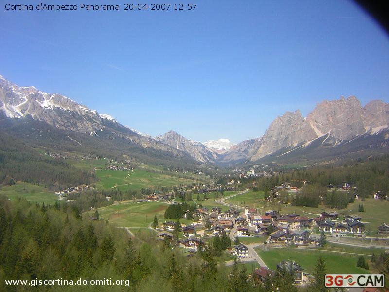
Webcam
from near the camp site - this is the view from the Olympic
ski jump just down the road from the camp site, a very similar view to the one
we get for the week. See below for a recent picture.
Ettore’s ‘e’ grade – travelling the Via Ettore Bovero on Saturday 21st July 2001
It wasn’t how I’d planned to spend my last day in the Dolomites. I stalked around silently with my own thoughts as I thought of the challenges ahead. I’d rather fancied a stroll around the plateau of Monte Piana, and the thought of an ‘e’ grade via ferrata with its vertiginous drops was perhaps more than I could stand. But as I lay in my tent thinking of the day ahead, I visualised how I would feel on the top having completed the ‘walk’ and decided it was better to try this than walk off on my own.
The day dawned bright and clear – the kind of weather we’d prayed for all week, but I couldn’t eat much breakfast at the thought of the rigours ahead. Linda had already told us that everyone feels nervous before a new climb – just the threshold at which you feel it gradually changes. Mine was about to be increased.
Parking at Camping Olympia (alt. 1300m) was the easy part – not much negotiation was required to be allowed to park all day in front of the No Parking signs. We set off through the shady woods, my pack all the heavier with the rope that I had insisted we take – ‘just in case’.
I knew it was a big climb up to the Passo Posporpora, after all we’d descended from there into Cortina only a couple of days earlier, but the easy gradient and the multitude of zigzags made it a steady plod. Not quite enjoyable, but bearable – even with six days of walking in our stiffening legs. Pausing at one point in the shade for a sip of water, I wondered whether my dented litre Sigg bottle would really be enough for such a hot day as this.
We paused at the col (alt. 1730m) to look for the mouse we’d seen earlier, but despite (or perhaps because of) copious poking about with Martin’s stick our little brown friend failed to surface. Now began the real climb up to the start of the via ferrata at around 1900m. This path was much rougher than the gentle amble up to the col – and even the lower stretches were not for the faint-hearted being somewhat exposed. I asked why the pause at a particularly dodgy section – ‘to look at the beautiful view’ was the reply. It was, but I wasn’t in the mood. A little higher we scrambled on to a rather wider ledge. I felt confident enough to take out my camera and take a few wide-angle shots way up the valley of the Rio Travenanzes towards Tofana and Falzarego.
Onwards and upwards, the waymarks now taking on more of a climbing feel, with red arrows pointing around corners and upwards. There were a few awkward moments – lucky for me Linda just in front was able to point out some easy handholds that made the route finding easier. Martin, a little further behind, paused for a rest at this point. (Actually, he stopped because he was stuck! – Ed)
It was a relief to finally reach the bottom of the route. The wires snaked up the white rock into the brilliant blue sky. We climbed into our harnesses. Linda proffered some nuts which I had difficulty swallowing. But it looked do-able which was good – I had pictured some vertical blank wall in my mind.
Rupert led from the front, followed by me and then Martin. I pulled up the first part, hearing words to take small steps but ignoring them in my anxiety to get up. Much of the route up was a daze. I looked out at the view with incredulity – not believing I was there. The worst part was always unclipping at the end of a wire while walking over ‘easy’ ground. I rushed for the next wire to make me ‘safe’. Rupert offered quiet words of encouragement. I wished I dared take out my camera to record the moment. Rupert took shots downwards where I dared not look. Then came a moment I couldn’t believe.
Just up ahead the wire disappeared horizontally around a corner. But where to put my feet? Rupert suggested I go ahead so he could take my picture – but even this opportunity failed to encourage me. Instead we had to execute a rather tricky manoeuvre on a very tight ledge. I was shown the controls on the camera, but all I could do was hold on tightly to the wire. I dared to let go with one hand as Rupert swung out onto the wire. One-handed picture with much camera shake, while Martin waited just below with his nose pressed to the rock. Moving around the corner was easier than expected, so we were soon on some easier ground below the summit rocks. There was a call for lunch but Martin, I suspect like me, wanted to be on the top. There were then several sets of ‘stempels’ – big iron staples drilled into the rocks before I finally saw the small wooden summit cross ahead to my right.
‘YESSSS!!!’
It was just as I visualised. We relaxed on the summit at 2166m, enjoying our lunch and taking in the wide-ranging views as the sun baked us. Many summit photos.
Then off down the long walk back. The conversation was light-hearted – from Laurence Llywellyn-Bowen to Charlie Dimmock. And we laughed as one of our fellow ‘mountaineers’ skipped past with a video camera slung over his shoulder as his only equipment! Much more in the way of war remains on the way down. Chris made a fine model poking his head out of a tunnel window 50 feet above us. And Sue made a fine sunshade with my hat so I could record the moment.
The rest of the journey down was uneventful, save for a rather ungainly scramble down a tree trunk, and some sarcastic comments from some Germans who looked rather disdainfully at our rope.
Ice creams were only noteworthy by their obvious absence at the entrance to Camping Olympia, so instead we returned to Cortina for a welcome beer (or lemonade…).
The day finished in style with a communal meal of highlights and leftovers from the week: seafood pasta, sausages – expertly cooked by Chris and Rupert – with a very large salad, a lovely Barolo wine and finished off with yoghurt with strawberry jam. And no rain.
In the middle of all this, Linda helped a small German child go to the toilet.
Nick Gray - 23rd July 2001
Click here to go back to the main site.